Below is our 5-day Pamir Highway itinerary which we did in January 2020. A trip to Central Asia won’t be complete without a visit to this famous highway. It transverses through the Pamir Mountains bypassing Afghanistan, Uzbekistan, Tajikistan and Kyrgyzstan, with the highest point of the pass at 4655 meters in altitude! No wonder many people believes that a winter trip to the Pamirs is extremely difficult.
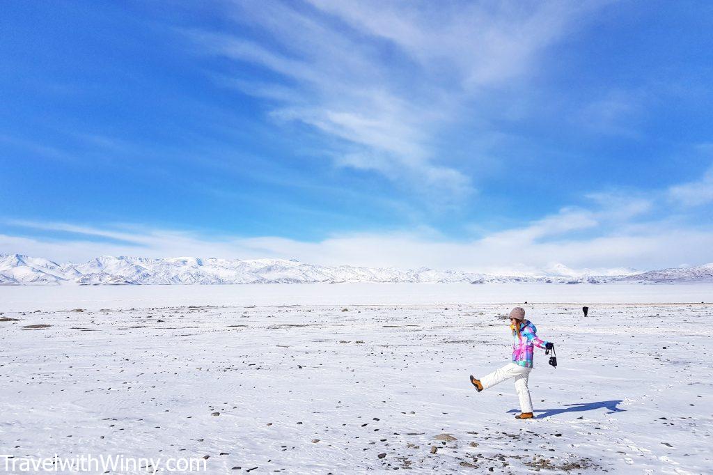
We thought we couldn’t survive the cold, but we were blessed with lovely weathers.
However, we still did our trip in the middle of winter in January, experiencing temperature as low as -50℃! The journey through these high mountains in winter was highly rewarding as the sceneries we saw was spectacular. Close to no tourists were daring to travel through this time of the year even though this highway is flooded with people in spring and summer.
What is the Pamir Highway?
The official name for the Pamir Highway is “M41” which was the Soviet road number. This route was also part of the ancient Silk Road trade route and is the only road that goes through Tajikistan’s Gorno-Badakhshan Autonomous Region (GBAO), where a separate permit is required. The region makes up 45% of Tajikistan but only just 3% of its population. In 1992 a civil war broke out in Tajikistan where GBAO declared its independence but ultimately failed.
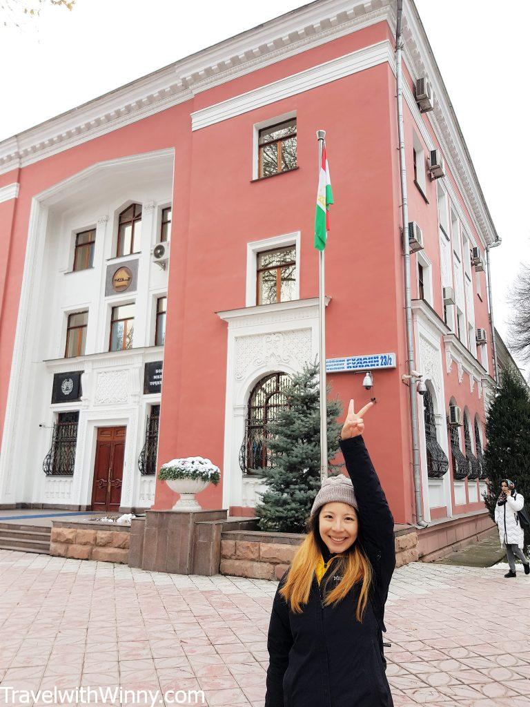
This photo was taken at the capital- Dushanbe. Tajikistan is the 80th country I have visited!
The official start of the Pamir Highway is debatable. Some say it’s the capital of Tajikistan- Dushanbe, some believe it’s Khorog- which is the main city of GBAO, others insists that it starts in Afghanistan or Uzbekistan. Either way, everyone agrees that the high way ends in Osh, Kyrgyzstan.

Among the Pamiris, there is a high percentage of people with blonde hair, fair skin and blue eyes, which is quite different to the Tajiks.
The construction of the highway started at the end of the 19th century and finished mostly by the Soviets in the 1930s. In the 2000s the Pamir Highway was connected with China. Hence that’s why during our road trip, we saw many Chinese trucks delivering supplies into the country.
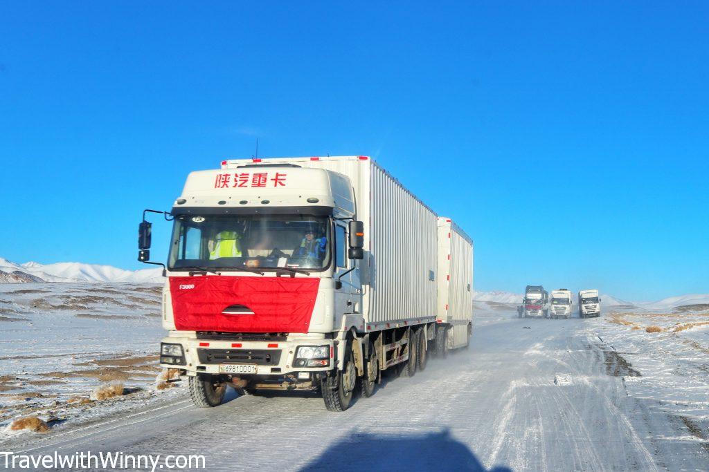
We saw many Chinese trucks along the way.
Besides being known as the second-highest highway in the world, this road also referred to as the “Heroin Highway”. On average, 90 tonnes of heroin are trafficked through this part of Tajikistan each year from Afganistan.
How to plan your Pamir Highway itinerary?
The Pamir Highway is not just one straight road. It contains a variety of detours along the way which makes the trip interesting. As many parts of the road are barely maintained, a 4 wheel drive will be the safest transportation to drive through the Pamir Highway. It is true that some regions of the Pamirs are off-limit in winter. However, being the main route of GBAO, the Pamir Highway is accessible all year round.
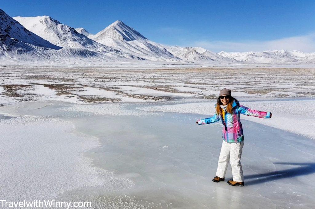
It is just so cold in winter, not many people want to do the tour during this time.
There are several ways of travelling the Pamir Highway. The cheapest way will be sharing rides with the locals along the way or hitchhike other tourists’ vehicles (for a small fee usually). Unfortunately, it is not possible to do it during winter as there are just not enough people visiting the region.
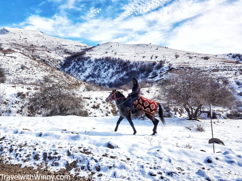
Horse-riding is a popular activity during the warmer seasons.
One of the most adventurous ways to travel through the Pamirs is via bicycle. It takes about 3-5 weeks to cycle through the Pamir Highway and the best times to do it is in summer where the weather is more pleasant. It is the ultimate pilgrimage route for thrill-seekers, so could be an option if cycling is your thing.
How much is it to hire a driver?
If you plan to hire a driver for 7 days, the cost is usually around USD$900. This does not include your food and accommodation. Budget around USD$15pp per night which includes breakfast & dinner. Our driver cost for 5 days from Dushanbe to Osh was USD$700 for the whole car with Tour de Pamir. I did receive quotes as high as USD$2000 for a similar itinerary, so remember to shop around!
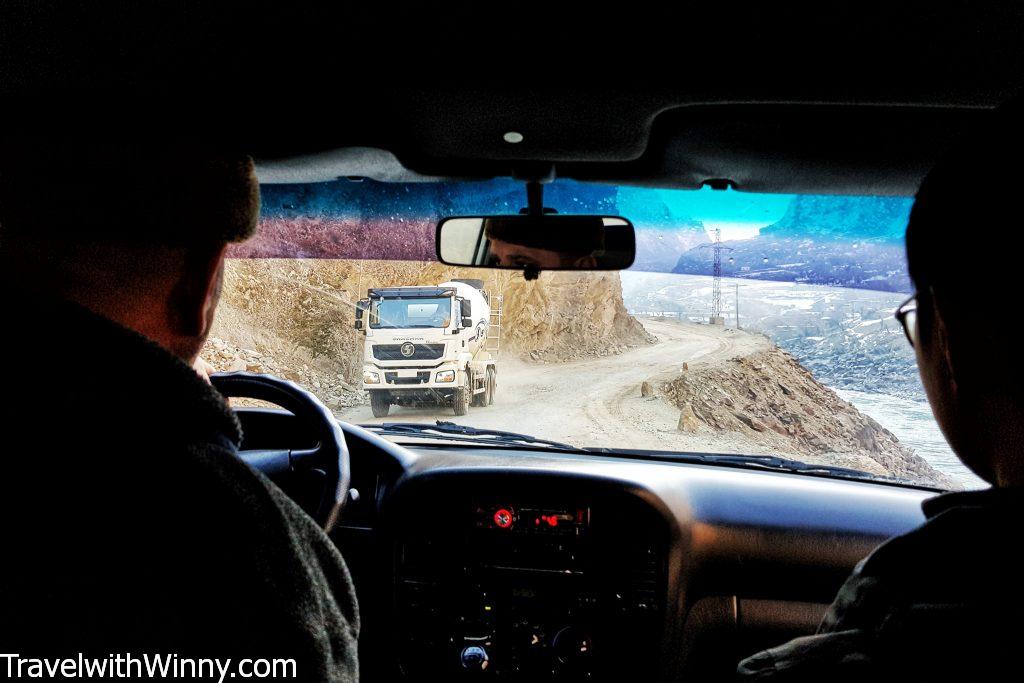
As the road conditions may be tough, you need to make sure you get a reliable driver and vehicle.
Of course, if you have other travellers to share the cost with you, the trip will work out cheaper. I found Indy Guide very useful for getting quotes from individual drivers and the drivers will propose a Pamir Highway itinerary for you. Remember to clarify what the quote includes, as some drivers may not include fuel or the driver’s expenses in the quote.
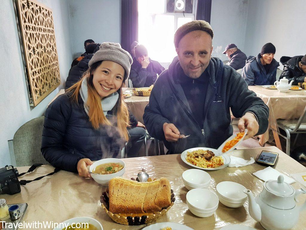
Our guide and driver who thinks I eat more than an average Tajik man.
Our 5-day winter Pamir Highway Itinerary
- Dushanbe to Kalai-Khum (6-7 hours of driving)
- Kalai-Khum to Khorog (6-7 hours of driving)
- Khorog to Alichur (5-7 hours)
- Alichur to Murghab (2-3 hours)
- Murghab to Osh (7-9 hours)
or the 5-day winter Pamir Highway Itinerary as suggested by the driver
- Dushanbe to Kalai-Khum
- Kalai-Khum to Jizeu Valley (no road to the village, need to hike 11KM return, 2 hours one way in summer)
- Jizeu Valley to Khorog
- Khorog to Murgab
- Murgab to Osh
or the 5-day Pamir Highway Itinerary suggested by the Lonely Planet Central Asia Guide Book
- Dushanbe to Kalai-Khum
- Kalai-Khum to Khorog
- Khorog to Langar via the Wakhan Valley with interesting villages along the way, unfortunately, the passes are over 4000 meters in altitude & are inaccessible in winter.
- Langar to Murgab
- Murgab to Osh
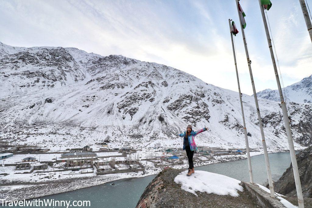
There’s no right or wrong route for your Pamir Highway itinerary, it just depends on what your interests are.
Our actual Pamir Highway Itinerary
Day 1: Dushanbe (800M) to Kalai-Khum (1287M)
On the first day, we departed Dushanbe early and headed towards Kulob– a city 203KM south-east of the capital. This city is the third-largest city in the country and has an airport. Kulob was first referred to by historians in AD737, therefore, a few historical monuments can be found here. Before arriving in Kulob, we passed through Norak water reservoir, the highest dam in the world.
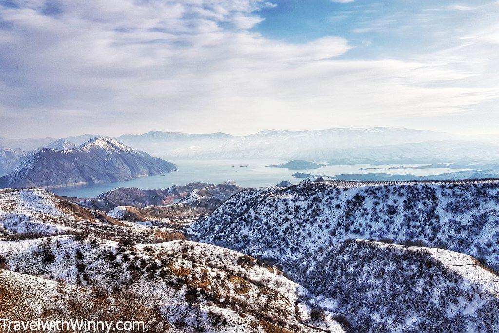
The Norak water reservoir that is also nicknamed “The Sea of Tajikistan”.
The most important site in Kulob is the Hulbuk Fortress. Destroyed by the Mongols, this fortified palace has been undergoing excavation since 1951. According to the Lonely Planet book, it is not possible to access the ruins. However, our driver tipped off some guards and he took us around the place with his broken English. There is a small museum opposite the site which we did not go in.
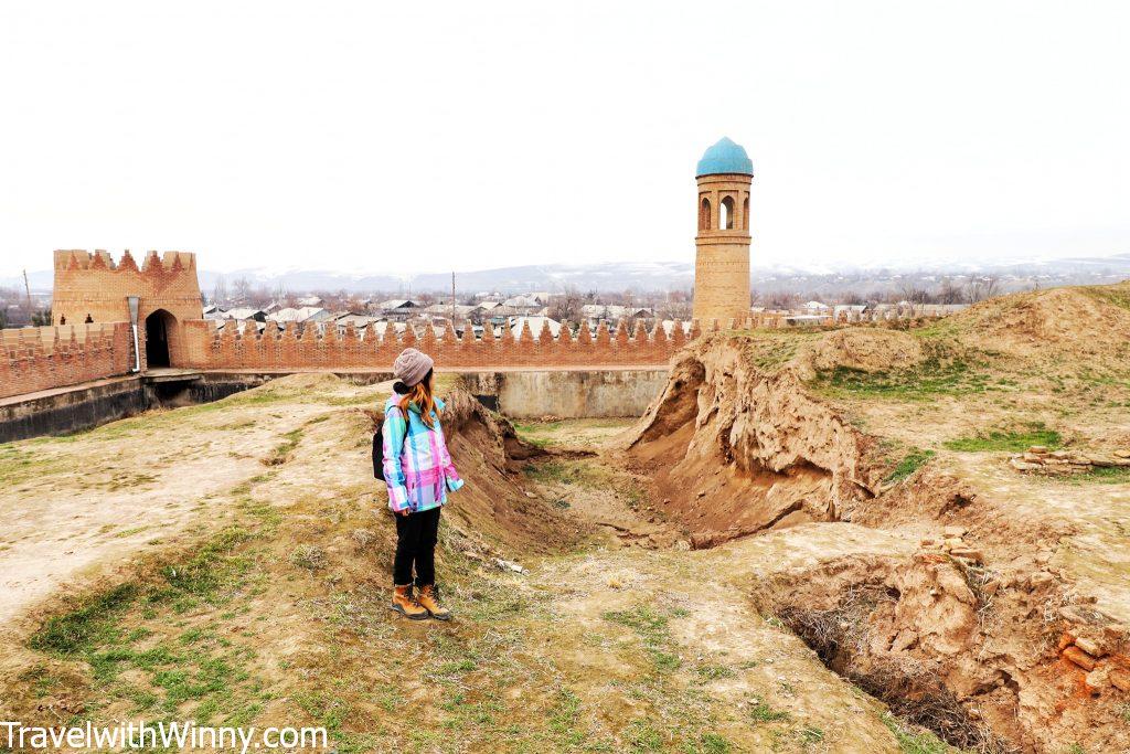
Inside the ruins of the Hulbuk Fortress. Surprised to see many local tourists within the complex despite the fact you aren’t allowed to enter.
The Mausoleum of Mir Said Ali Hamadoni in the city of Kulob is a pilgrimage site for many. The place even appeared on one of Tajikistan’s banknote. The person resting here is a scientist and a poet born in Iran in the 14th century. He brought Islam into the Kashmir region.
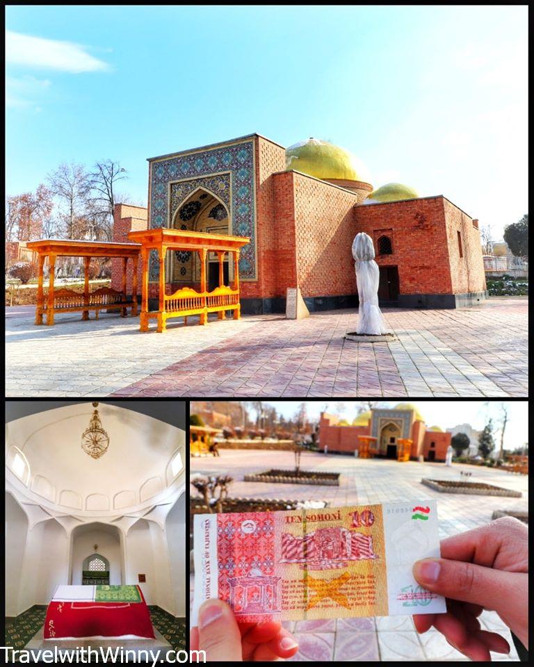
The mausoleum even appeared on Tajikistan’s banknote.
As the trip between Dushanbe and Khorog is between 14 to 20 hours, Kalai-Khum is the most popular overnight stop. We arrived here just before sunset and didn’t have time to explore this charming town with a river bypassing through its centre. The accommodation here is simple and we had our meals in the guesthouse. They did give us an electric heater which wasn’t very sufficient for the size of the room.
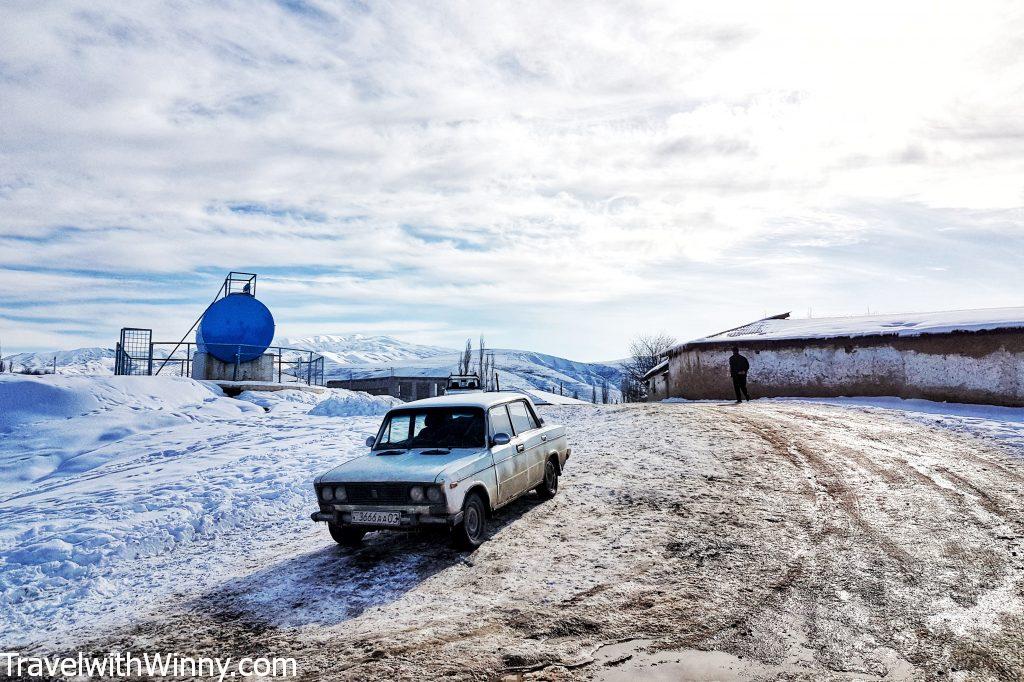
There are many small villages along the Pamir Highway.
Day 2: Kalai-Khum (1287M) to Khorog (2145M)
The next morning we departed early and headed towards Khorog– the administrative centre of Gorno Badakhshan and the Pamir’s largest town. We actually met a few students who stayed in Green House Hostel when we were in Dushanbe. Apparently, one of the three campuses of the University of Central Asia is in Khorog. This university was founded in 2000 by the governments of Kazakstan, Kyrgyzstan and Tajikistan.
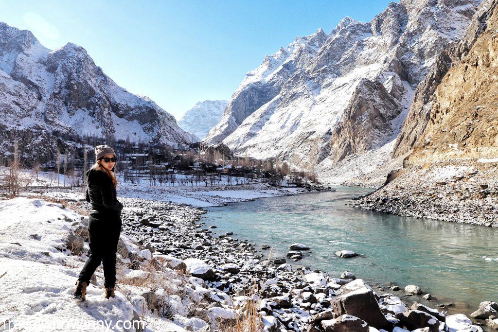
It is possible to visit Afghanistan by obtaining a visa at Khorog.
The drive today was transversing through the 1125KM long Panj River that forms a considerable border between Tajikistan and Afghanistan. It was strange looking at the Afgan villages on the other side of the river. Afghanistan to me has always been a distant war-torn country, yet the villages in this beautiful valley appeared so peaceful.
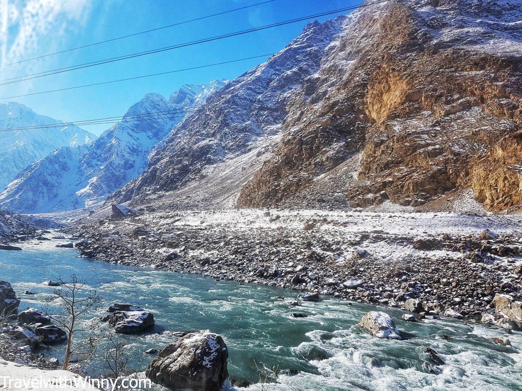
This is the river that separates Tajikistan to Afganistan.
Later I found out this part of Afghanistan is one of the safest places in the country and known as “the Little Pamirs”. It was a buffer zone between the Russian and British empires during the 19th & early 20th centuries. You are able to get a visa into Afghanistan at Khorog consulate in 48 hours. However, you will need a double-entry Tajik visa to get back into the country.
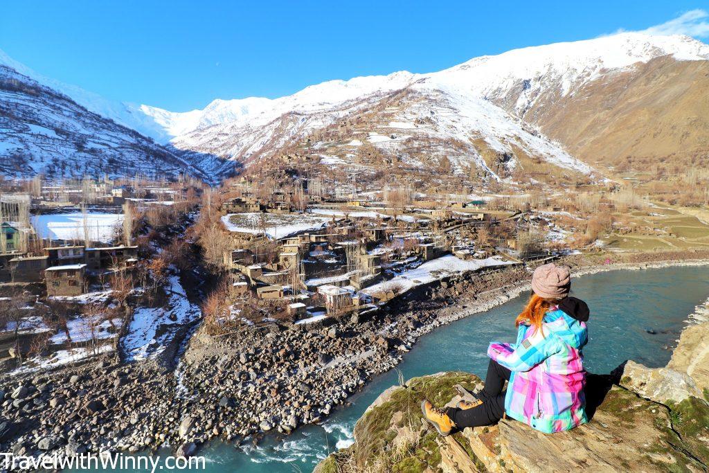
One of the most amazing things along the trip is to look at Afghanistan across Panj River.
That late afternoon, we visited the Pamir Botanical Garden just outside of the town. It claimed to be the world’s second-highest botanical garden. To our surprise, this is the location of the president’s summer residence. Our driver drove us to the top of the hill where the botanic garden is located. As we walked towards the garden entrance, we were stopped by two armed guards with automatic rifles in their hands.
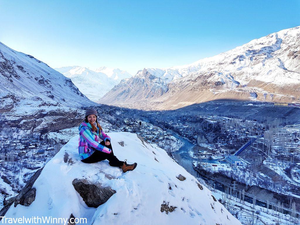
The only side we can face inside the botanic garden without getting into trouble.
They checked our passports, questioned why we were here and told us we can only take pictures of the viewpoint but not in any other direction as we might accidentally take a picture of the president’s residence. It was quite an uncomfortable experience being semi-interrogated by armed guards. Apparently the president only stays at this residence once every year or two years.
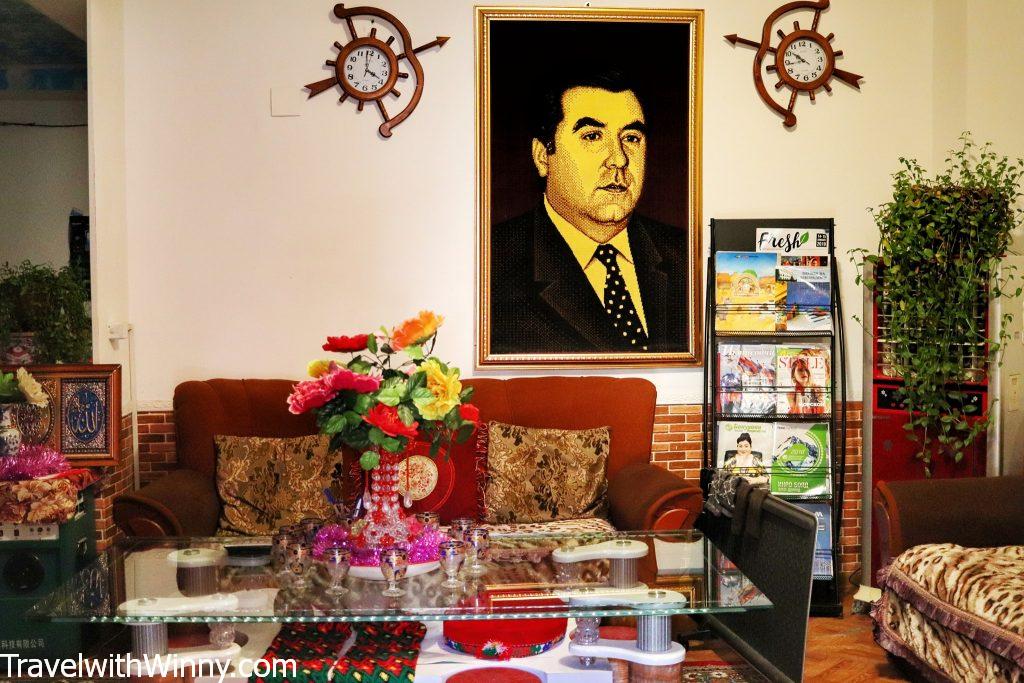
The image of the Turkmenistan president is everywhere. Even in the lobby of our hotel in Khorog.
Day 3: Khorog (2145M) to Alichur (3942M)
The Saturday Market is a must-see in Khorog! Once a week the bridge linking Afghanistan and Tajikistan opens up. This allows the Afghan traders to sell their products in Tajikistan. Observing the Afganistanies and seeing them at work was fascinating. The Afghan men and women dress quite differently to the local Tajiks.
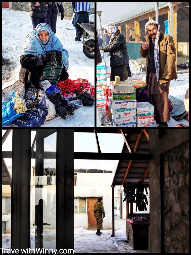
The armed guards patrolled the market and at one point one even checked my camera. Our driver told us that the Afghan women and men dress differently to the Tajiks.
Although due to increased Taliban activities, the market was full of police/military personnel. A guard even prohibited us to take photos. Apparently, the market will be suspended when the tension in the region escalates. We had a peek at the actual bridge itself, where the Afghans were checked thoroughly.
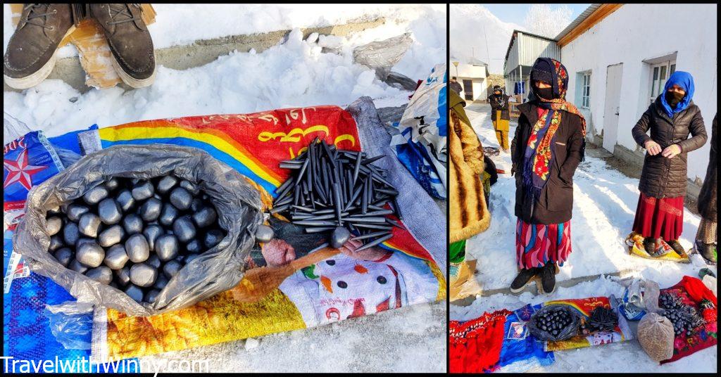
These are traditional eye make up used by Afghan women, they are called kajal. It actually causes lead poisoning in people.
Around noon, we started our drive towards Bulunkul village– the coldest place in Tajikistan, where the record temperature was -60℃! On the day we were there, it was -49℃! Fortunately, it was a sunny day and it didn’t felt cold at all.
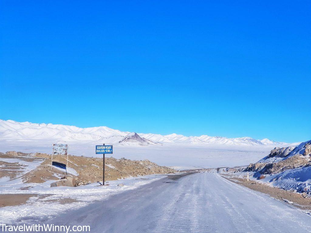
The road sign towards the Bulunkul Lake, quite hard to tell where is the lake as everything is covered in snow.
There are around 100 people living in the village and it’s just amazing seeing how resilient these people are despite the harsh climate! Next to the village is the famous Bulunkul Lake. Tourists come here and do horse riding near the lake during summer. However, I couldn’t see the lake at all since it was covered in white snow!
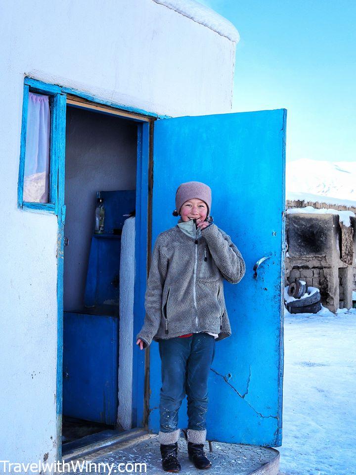
The sweet girl in Bulunkul village who is not shy of the camera.
The town we stayed in for the night was Alichur, with a population just under 2000. The owner of the homestay heated our room with compacted cow manure and coal, so we had a warm sleep. He told us that many guesthouses are closed in winter because people don’t have enough money to buy coals to provide warmth for the guests.
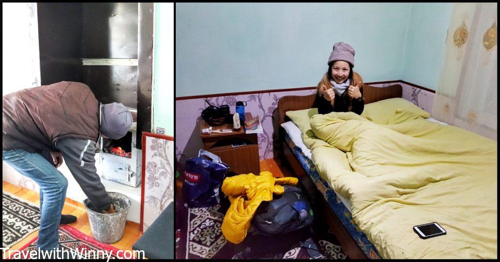
The combination of cool and cow dump, surprisingly kept us warm the whole night.
Day 4: Alichur (3942M) to Murghab (3600M)
The temperature that night reached well below -50℃. York was losing his appetite and developing a light headache, while my heart was racing very fast. Having experienced the same altitude sickness on Inca Trails in Peru, we recognized the symptoms and took a precautionary Diamox the next morning.
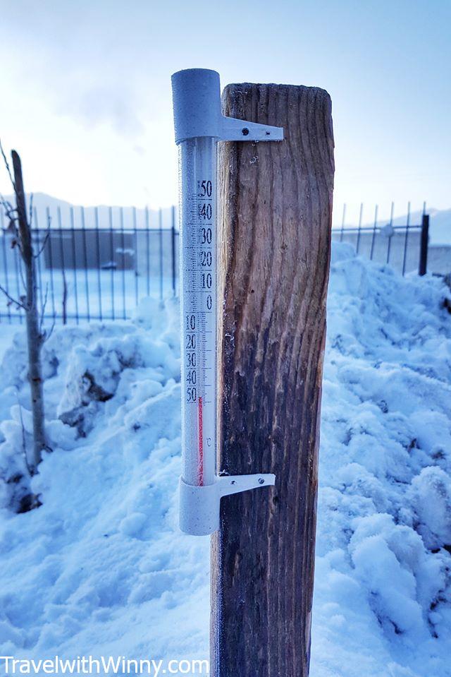
This was the temperature after sunrise, it must be colder than this last night!
Situated between 3 high passes each over 4100M, Alichur has spectacular high-altitude scenery. This region is also famous for the critically endangered Marco Polo sheep! These sheep were first described by Marco Polo and they have the longest horns out of all the sheep!
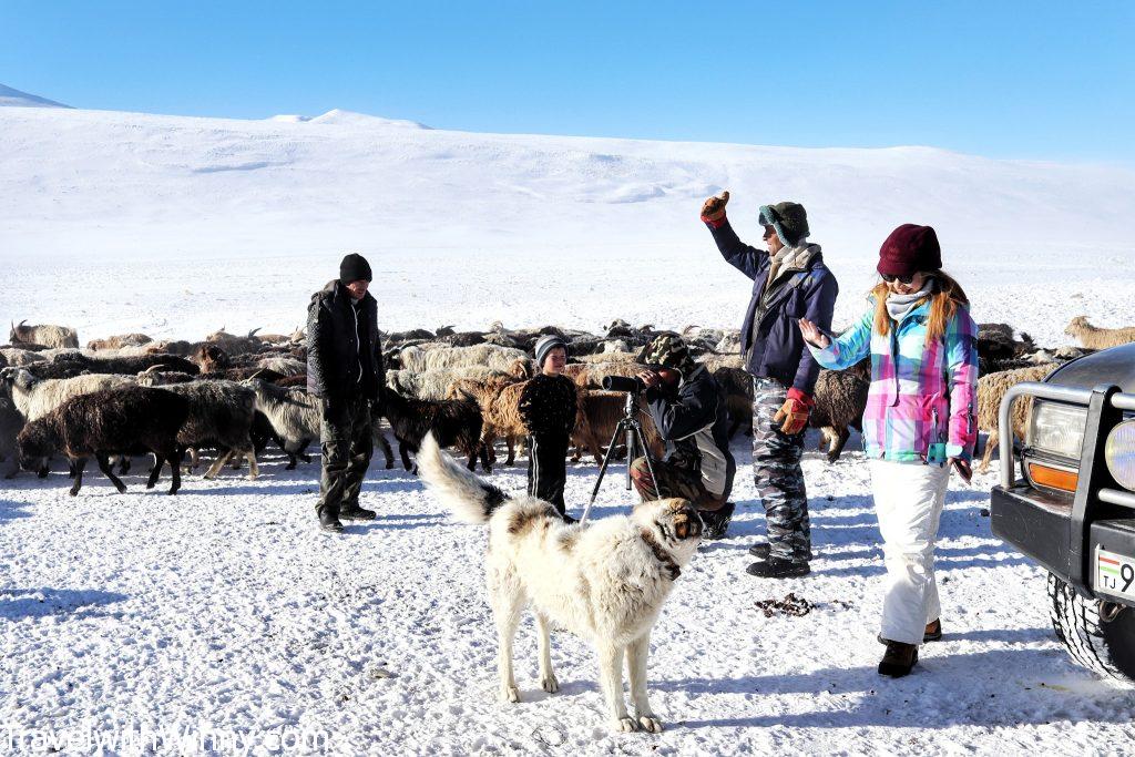
We were taken to another village nearby where the locals know the whereabouts of Marco Polo sheep.
The longest horn was measured being 1.9 meters and weighed 27 kg! Although on average, they about 140cm long. Unfortunately, trophy hunters are paying up to USD$40,000 to hunt them as these horns are attractive on their walls. Sad to see that some humans don’t care if they drive species to extinction.
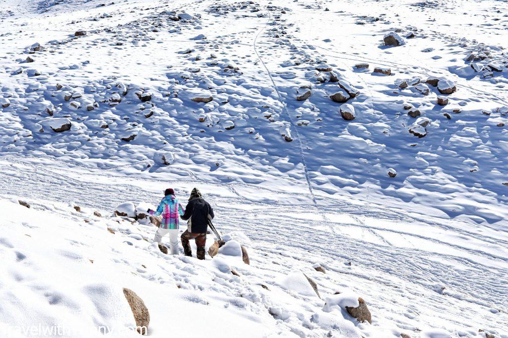
We were in our car first, until the snow was too deep we had to get out of the car and walk.
They are easier to find in winter as they come down from the mountains to feed. Though they are very sensitive animals, so you can’t get too close to them. The closest we got was a distance that I could JUST see them with my naked eyes! We also saw ibex. In total, we spent about 2 hours hiking in deep snow at 4000M in altitude at -45℃ temperature. It was definitely a type II fun.
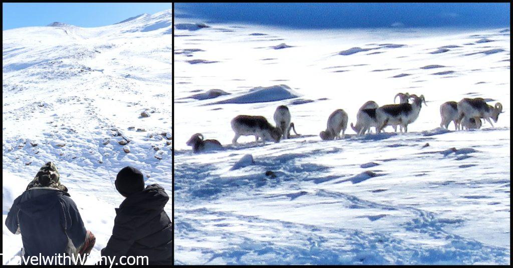
The Marco Polo sheep were so far away, I had to use a binocular!
The activity was an extra USD$60 to the local guides, but it was worth it as many hiking routes are inaccessible in winter. This added variety to our Pamir Highway itinerary, not just endless snowy mountains.

Apparently the longest record horn was 1.9 meters long, so this one probably was still a youngster.
Our stay in Murghab
As it was difficult to find places to stay in winter Pamirs, we stayed with our driver’s wife’s sister’s house in Murghab. This town is situated in the middle of the high Pamir plateau. From here you can either go north towards Osh in Kyrgyzstan or east over the Kulma Pass to the Karakoram Highway in China connecting to Kashgar. On a sunny day, you can see the snowy peak of Muztagh Ata (7546M) in China above the horizon.
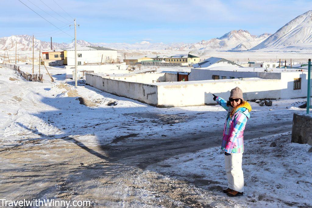
Can see Muztagh Ata in the distance from the village of Murghab, it’s the second-highest peak in the Tibetan Plateau.
Originally we were quite excited to stay in a local’s house. Until we found out that we actually took their only heated room and the mother and son had to sleep in the kitchen next to us. Throughout the night, both rooms were heated by the stove that was built within the sharing walls. Till this day, we still don’t know how the two fit in that small kitchen area.
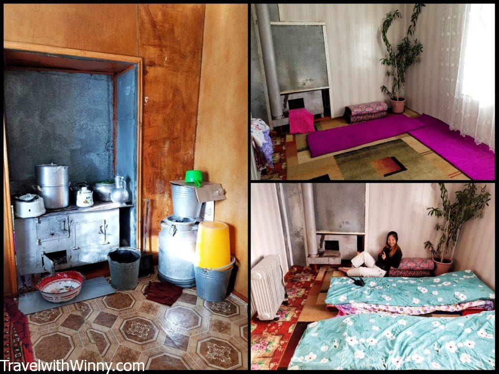
The stove successfully heated up both rooms overnight.
The toilet in this house required us to leave the house from the front door and enter the backyard from the side. There was an enclosed area with four walls, but no roof! What happens if it rains/snows? The temperature was so cold here, it stings when we touched the metal lock on the door.
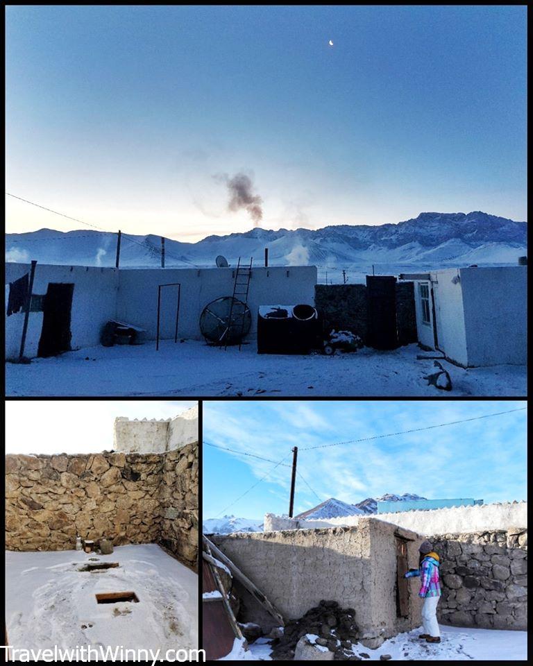
The courtyard with the open-air long drop. Must be freezing cold when there’s a blizzard.
The bazaar here is quite different as well. The shops are set up inside cargo containers. There is also a mosque at the end of the town. On the side note, the time zone in Murghab runs on Kyrgyzstan time, so an hour ahead of Dushanbe and Khorog.
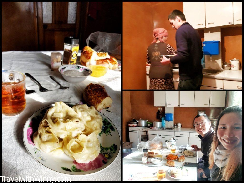
The mother and son who made us feel very welcomed. However, they didn’t eat with us, almost acted like a waiter & let us be.
Day 5: Murghab (3600M) to Osh (963M)
Today is a long drive from Murghab to Osh. This high-altitude section of the Pamir Highway follows a fenced area of “neutral zone” between Tajikistan and China and crosses the highest point of the highway- Ak-Baital Pass (4655M). Some of these fences were not well-maintained, we joked about the ease of crossing into China illegally.
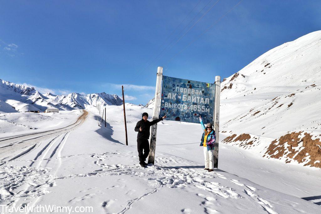
Standing at the highest point of the Pamir Highway!
We stopped at Karakul– the biggest lake in Tajikistan. The lake is situated in a meteorite crater of 52KM in diameter, the lake itself is 25KM in diameter. It hoped to compete with Lake Titicaca in Peru/ Bolivia for the highest navigable lake in the world.
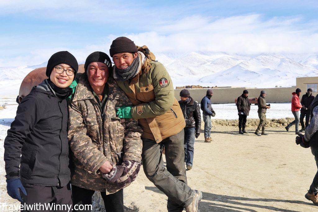
York bonding with the local Karakul village men.
Unfortunately, the lake is frozen at least half of the year, so in theory, it’s not really navigable. In summer, this huge lake transforms into a sky-blue colour that varies according to depth.
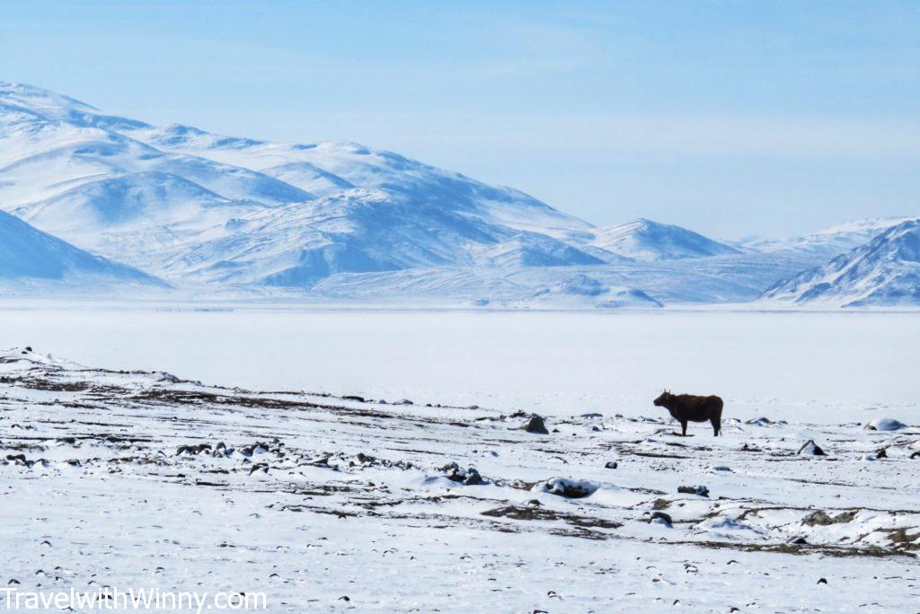
The snow-covered Lake Karakul with yaks surrounding the share.
The Tajik border is about 60KM north of Karakul. There’s a 20KM of “no man’s land” between the two before you reach the Kyrgyz border. That’s why there are huts along the road, supposedly for cyclists in summer where they can take a break or stay here for the night. According to the Lonely Planet book, taxi needs to have the right paperwork otherwise they cannot go into Krygyzstan.
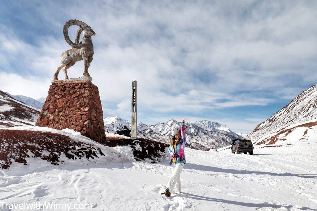
This photo was taken between Between Tajikistan and Kyrgyzstan border, where they are 20KM apart.
Into Krygyzstan
Not too far from the Kyrgyz post is the village Sary-Tash where we had lunch. There’s a chance to see Lenin peak (7134 M), a mountain where many mountaineers try to conquer. After passing the high passes into Krygyzstan, we started descending rapidly. The sceneries started to change and we started to see trees for the first time in many days. Krygyzstanies love their horses, they were everywhere once we crossed the border. We noticed many locals riding and herding large groups of horses to the stables. Apparently, they ride just to go do local food shopping.
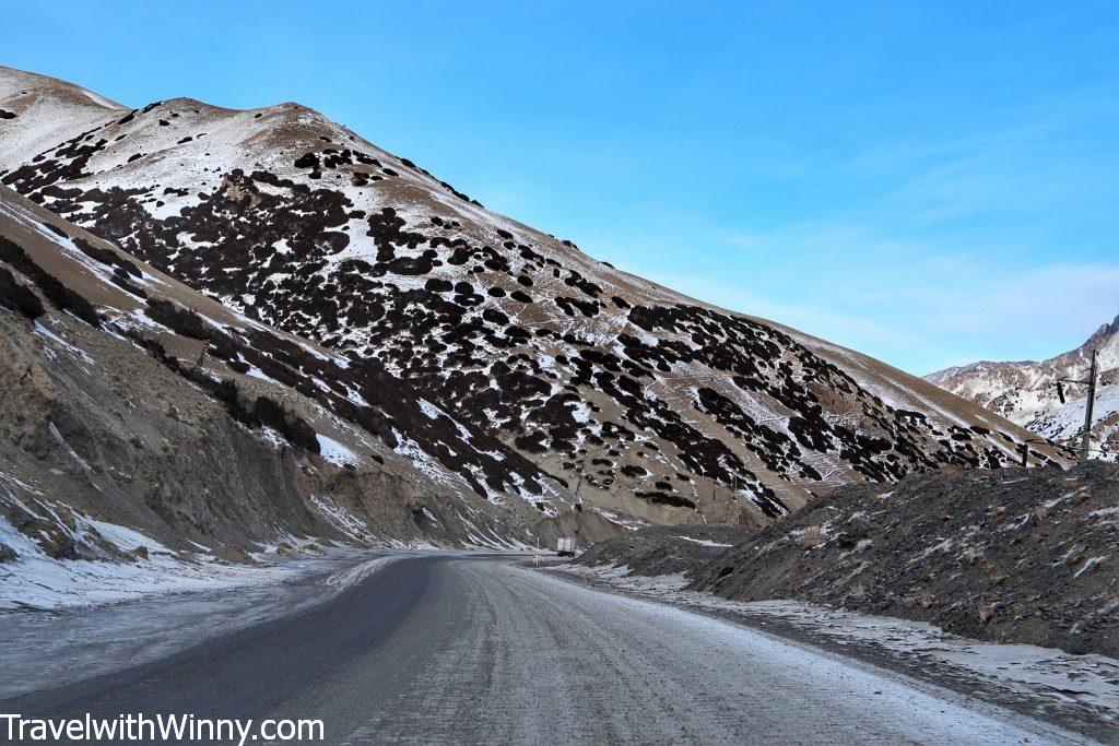
It was nice to see a bit of greenery after being in the snowy mountains for 5 days.
We arrived in Osh just passed 7 pm and completed our 5 day Pamir Highway itinerary. It was nice to be back in civilization. Things we take for granted such as running water wasn’t readily available at high altitudes. The locals had to heat up the water that they gathered from the well and pour it onto our hands so we can wash them. Our hands felt disgusting after not being able to wash them properly after 5 days. However, we were happy to achieve what many travellers believe to be unachievable; to cross Pamir Highway in winter!
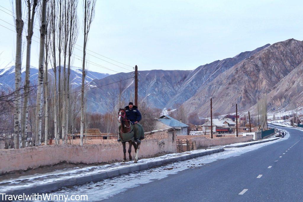
Didn’t successfully take the photo of the guy who rode their horse onto the streets to buy some groceries, this will do.
Tips for Travelling the Pamir Highway in winter
- There are no ATMs available, so bring cash. The locals prefer local currencies rather than USD as its hard to exchange unless they go into town.
- Bring spare batteries as many of the guesthouses runs on the solar panels. It may also be too cold to charge your electronics as the cold temperature drains the power faster than it can change.
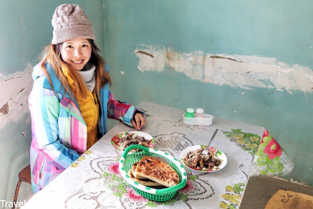
There are not many places open on the Pamirs in winter, so you just have to eat what everyone else is eating.
- You can buy bottled water in Khorog, though the locals usually drink tea. Bring an insulated water bottle so you can keep yourself warm.
- In winter, many restaurants and guesthouses are not open, therefore, options may be limited.
- There is no internet once you leave Dushanbe and Khorog, hence a sim card is required if you need to be connected.
- Please bring altitude sickness medications as the altitude here is over 3000M.
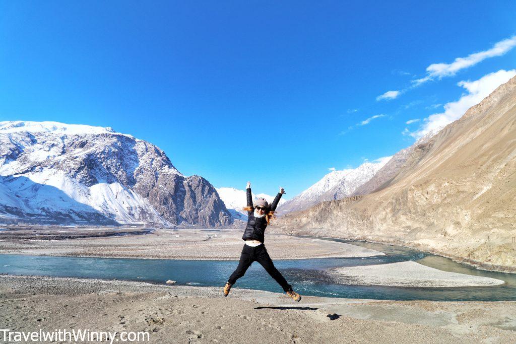
Yes! We survived the winter Pamir Highway!
Above is 5 day our Pamir Highway itinerary, hopefully, you will find it helpful. If you enjoy this blog, don’t forget to follow us on IG @ travelwithwinny and see more of our travel stories! Or follow our Facebook page @ Travel with Winny.
在 Instagram 查看這則貼文
Leave a Reply